|
|
|
 |
Map
of this Destination Provided by |
 |
Cochise County, located in the southeastern corner
of Arizona, is known as Old West Country. In this region of great scenic
beauty one can breathe fresh mountain air, explore old mining towns
and even walk the lands where Apache Chiefs Geronimo and Cochise once
battled the U.S. Cavalry. This is truly a place to step back into time.
|
|
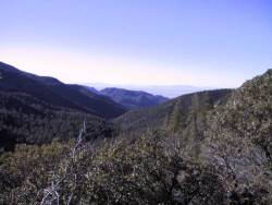
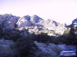
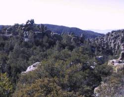
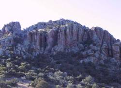
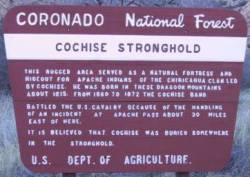
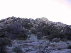
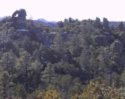
Cochise Stronghold is a natural granite fortress
located in the east face of the Dragoon Mountains. During the Indian
wars, this area of tall bluffs and rugged canyons was used by the Chiricahua
Apaches and their leader Cochise as a haven to hideout from the U.S.
Cavalry. It is rumored that when Cochise died he was buried in Stronghold
Canyon and his followers ran their horses up and down the canyon to
erase all traces of the grave.
|
 |
 |
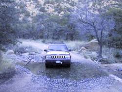
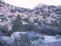
Today, the Stronghold is a hiking and picnic area
maintained by the National Forest Service. There is also a small campground
which is very beautiful, but not recommended for larger rigs.
|
|
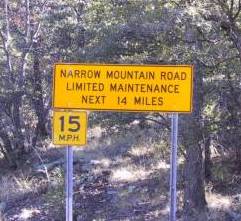
If you go, from Interstate 10 just west of Wilcox,
head south on Highway 191 (exit331). Near the town of Sunsites follow
the Cochise Stronghold Sign at Ironwood Drive to Cochise Stronghold
Road. This road is a 10-mile, mostly dirt road, but the views are well
worth the trip.
|
 |
 |
 |
 |
 |
|
Further information can be obtained by calling
520-364-3468.
|
|
 |
 |
|
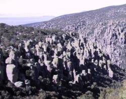
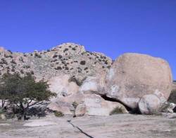
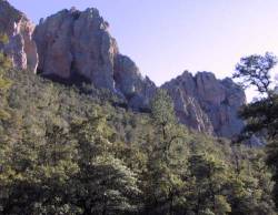
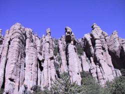
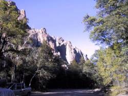
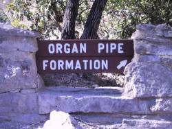
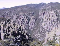
Chiricahua National Monument, located about 36
miles southeast of Wilcox, is definitely an awe-inspiring sight. Also
known as the Wonderland of Rocks by the pioneers, these formations of
rock forests are absolutely striking. Here you will find towering rock
spires, massive stone columns and incredible balanced rocks weighing
hundreds of tons perched precariously on small pedestals.
|
 |
 |
 |
 |
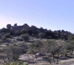
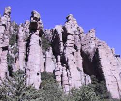
Considered sacred and called the Land of Standing-Up
Rocks by the Chiricahua Apaches, this area of extraordinary rock sculptures
was created by the forces of nature over millions of years.
|
|
Geologists believe that long ago volcanic eruptions
from a nearby caldera spewed forth thick white-hot ash which cooled
and fused into volcanic rock known as rhyolite. Mother Nature then sculpted
these formations with water and wind erosion.
|
 |
 |
 |
|
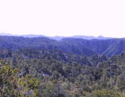
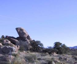
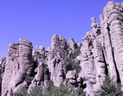
Except for Bonita Canyon Drive, a paved scenic
eight-mile drive climbing gradually to the Mountains crest and Massai
Point, the entire area is a declared wilderness area. The 6,870 foot
overlook at Massai Point offers commanding views of the park.
|
 |
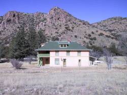 |
The Ericksons, a Swedish immigrant couple, were
among the first pioneers to settle in this area around 1888. Their home,
located in remote Bonita Canyon nestled in the foothills of the Chiricahuas,
became Faraway Ranch in the 1920s when their daughter Lillian and her
husband Ed turned the homestead into a guest ranch.
|
|
Together, Lillian and Ed explored the Chiricahua
wilderness, built trails and promoted the idea of a national park. In
1924, Chiricahua National Monument was established.
|
 |
|
A guided tour of Faraway Ranch is available for
$2.00 per person.
|
|
 |
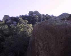
There are approximately 20 miles of hiking trails
in the park ranging from 1/4 mile to 9 miles in length. This is truly
a hikers paradise!
|
|
The Monument also offers a Visitor Center which
has exhibits, slide shows, schedules of park programs and detailed hiking
maps. Make note, there is a small, scenic campground which provides
first-come, first-serve camping for units up to 26 feet, but there are
no gasoline or food services located here.
|
 |
|
If you go, from Interstate 10 just east of Wilcox,
head south approximately 36 miles on highway 186.
|
|
|
Admission is $6.00/car and additional information
can be obtained by calling 520-824-3560 or logging onto
|
|
 |
 |
 |
|
|
To tour Cochise Stronghold and the Chiricahua National
Monument in one trip: After leaving the Cochise Stronghold, continue
south on Highway 191 to east on Highway 181 to north on Highway 186.
|
|
